
Drone Photogrammetry
Project Overview
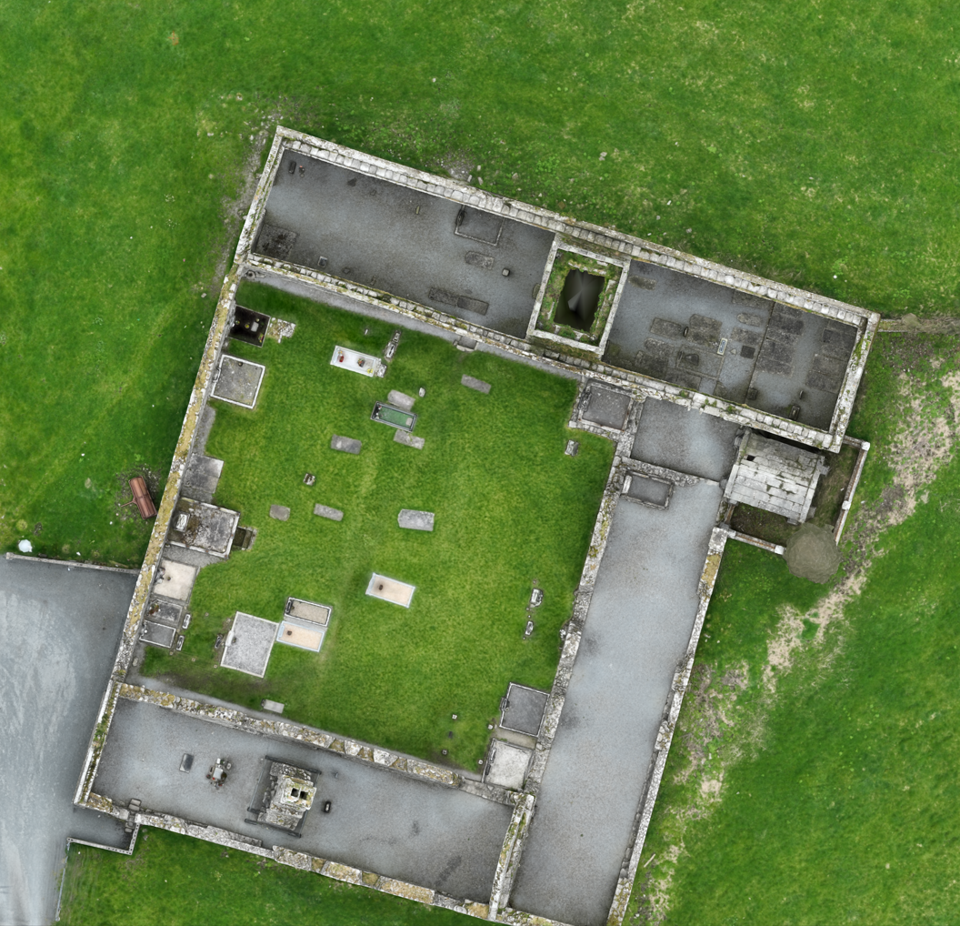
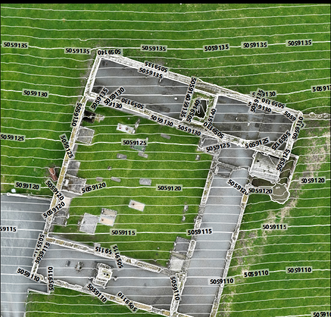
TruScan was commissioned to undertake a high-fidelity photogrammetric survey of the Clare Abbey ruins—an Augustinian monastery founded in 1189, located just south of Ennis—using a DJI Matrice 4E UAV. The scope included acquiring detailed imagery via automated flight paths and generating a georeferenced 3D model and orthophotos to support heritage conservation, site analysis, and academic research.

Client Objectives
Key goals as defined by the heritage authority included:
Capturing comprehensive visual data of the ruin from all accessible angles.
Producing an accurate, georeferenced digital twin for archival and interpretative purposes.
Minimising physical intrusion and preserving the site's integrity while ensuring positional accuracy for scholarly use.
Deliverables
Georeferenced High‑Resolution 3D Model suitable for digital archiving, structural analysis, and virtual reconstruction.
Orthophoto Maps of the ruin and surrounding topography.
RTK‑Aligned data for integration into GIS, CAD, and conservation management systems.
Outcome & Impact
Efficient Completion: Entire operation (capture, processing, and model delivery) concluded within two onsite sessions.
Accurate Results: Final model achieved ±2 cm spatial accuracy, confirmed through metadata validation in DJI Terra.
Heritage Value: Delivered dataset supports conservation planning, historical research, and potential VR/education uses.
Stakeholder Satisfaction: Heritage authority praised the non-invasive method, locational precision, and agile deployment in a sensitive environment.
Conclusion
This project demonstrates the effectiveness of UAV-based photogrammetry—particularly the DJI Matrice 4E—in heritage documentation. Combining Smart 3D Capture, RTK georeferencing, and advanced image processing delivers a high-precision digital asset with minimal environmental impact. It sets a benchmark for future surveys of archaeological and heritage sites.
Methodology
Utilising the DJI Matrice 4E’s advanced Smart 3D Capture workflow, the photogrammetry workflow proceeded as follows:
Automated Flight Planning: Initial rough model generated onsite via oblique imagery, enabling the drone to calculate an optimal mapping route around the ruin.
Precision Image Capture: Executed automated flight using 5-directional oblique capture at 0.5 sec intervals, leveraging the Matrice 4E’s mechanical shutter and distortion correction features.
Georeferencing: The survey achieved absolute accuracy using the integrated RTK system; the imagery was processed with positional metadata in DJI Terra to align the model to real-world coordinates without ground control points.
Technology & Execution
Drone Platform: DJI Matrice 4E, equipped with 20 MP 4/3 CMOS sensor and RTK GNSS.
Capture Modes: Combination of Smart 3D Capture for structural context and manual oblique flights for hard-to-reach areas (e.g. cloister arches).
Processing Pipeline: Image alignment and point cloud generation in DJI Terra, followed by mesh creation and orthophoto extraction. Final deliverables georeferenced within centimetres.